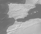
Gray Earth with Shaded Relief, Hypsography, and Ocean Bottom

Ocean bottom represented by CleanTOPO2 with reduced contrast.
Download small size (23.6 MB) version 3.2.0
About
Relief shading and hypsography derive from modified SRTM Plus elevation data at 1km resolution. Modifications include patching the eastern Himalayas and southern Andes with better elevation data from Viewfinder Panoramas. Daniel Huffman, University of Wisconsin, Madison, created the regionally equalized hypsography that forms the foundation of Gray Earth. File size: 10,800 x 5,400 pixels.
Version History
- 3.2.0
- 2.0.0


