Raster imagery 1.0.1 released

Posted in Miscellaneous on January 9th, 2010 by Nathaniel – 2 Comments

The 10m and 50m raster data on the NE download pages are updated and now contain corrected TFW files. The 1.0.0 files were a tiny bit off in their extents, the new 1.0.1 files are now perfectly within the ±180, ±90 bounding box.

The bad extent was throwing an error for some GIS systems on import and leaving gaps when reprojecting in the area of the international date line for others.

We’ve tested in ArcGIS 9.3.x in NSD Pro 5 georeferencing the rasters with the TFW files and reprojecting them. No funny gaps appeared at the 180th meridian. Thanks for edcorkery and user4815162342 in the Forums for first discovering this and Hans for the solution. Please let us know if you still experience reprojection problems.

Natural Earth Browser from Thematic Mapping

Posted in Miscellaneous on January 4th, 2010 by Nathaniel – Comments Off on Natural Earth Browser from Thematic Mapping

[Editor’s note: Bjorn over at his Thematic Mapping Blog has done up a Natural Earth tile set using open source tools. How have you been using Natural Earth?]

Excerpted from Thematic Mapping Blog.

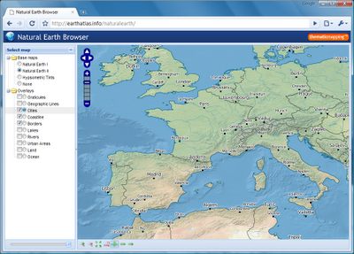
My holiday project, apart from skiing, was to play with the new Natural Earth dataset. By combing raster and vector data you can make a variety of visually pleasing maps. You can use my Natural Earth Browser to study the great linework of Natural Earth.
Natural Earth Browser was created with a variety of open source tools. Map tiles from raster data was created with MapTiler and optimised with pngng. Map tiles from vector data was styled with Mapnik and pre-genereated with TileCache. The map interface is based on OpenLayers, Ext JS and GeoExt.

Planning for our first data update

Posted in Miscellaneous on December 7th, 2009 by Nathaniel – Comments Off on Planning for our first data update

We’ve had a good first 3 business days and it’s rewarding to see folks writing in with corrections and addendums. This is, after all, a group volunteer effort and it’ll only get better with your input so please keep using the Corrections system and talking back in the Forums.

We’re hoping to have the first rounds of edits made before Christmas and then another update in early Spring 2010. Edits are primarily focused so far in the populated places (towns), admin-0 (countries), and physical features (point labels). The Spring update will include an overhaul of our admin-1 features with better coding for thematic mapping.

Do you have data to contribute or have time to review the existing data for errors? Great! Possible data for future updates include transportation (roads and railroads), time zones, and terrestrial hypsography. Please reference our guidelines about creating new data. If you have ideas for Natural Earth or want to show how you’re using the data in the map gallery, please drop us a line.

So far we’ve had about 7,000 visitors, over 30,000 pageviews, and about 9,000 downloads (both a la cart and combo meal) from 95 ISO countries around the world. Our average time on site of 4 minutes. Please keep it coming!

Let the Downloads Begin!

Posted in Miscellaneous on December 2nd, 2009 by Nathaniel – 4 Comments

Tom and I are pleased to announce the immediate availability of Natural Earth, free vector and raster map data at 1:10m, 1:50m, and 1:110m scales. This is a NACIS and MapGiving co-branded product with assistance from the University of Wisconsin-Madison cartography lab, Florida State University, and others.

Do you have a new theme to contribute to Natural Earth? Great! Please follow these data creation guidelines so it fits in with the rest of the project. Find an error? Log it via the Corrections system.

Why Create Natural Earth?

We have two goals:

First, to give cartographers an off-the shelf solution for creating small-scale world, regional, and country maps. To this end, Natural Earth Vector includes both cultural and physical features and builds on Tom Patterson’s Natural Earth raster data, first introduced in 2005.

Second, we include many features missing from people’s mental map of the world in the hope of improving overall geographic literacy.

Natural Earth Vector solves a problem that many NACIS members face: finding vector data for making publishable-quality small-scale maps. In a time when the web is awash in interactive maps and free, downloadable vector data, such as Digital Chart of the World and VMAP, mapmakers are forced to spend time sifting through a confusing tangle of poorly attributed data. Many cartographers working under tight project deadlines must use manually digitalized bases instead.

Small-scale map datasets of the world do exist, but they have their problems.

For example, most are crudely generalized—Chile’s fjords are a noisy mess, the Svalbard archipelago is a coalesced blob, and Hawaii has disappeared into the Pacific two million years ahead of schedule. They contain few data layers, usually only a coast and country polygons, which may not be in register with each other or modern satellite imagery. The lack of good small-scale map data is not surprising. Large mapping organizations that release public domain data, such as the US Geological Survey, are not mandated to create small-scale map data for a small user community that includes mapmaking shops, publishers, web mappers, academics, and students—in other words, typical NACIS members. Natural Earth Vector fills this oft-overlooked but important niche.

Collaboration

Making Natural Earth Vector is a collaboration involving many volunteer NACIS members. Nathaniel Vaughn Kelso and Tom Patterson began working on the project in late 2008. Following the path of least resistance, the idea was to repurpose existing data that we already had as an integrated world dataset at three map scales.

The 1:50 million and 1:110 million-scale data comes from bases developed by Dick Furno and additional staff at the Washington Post for quick turnaround newspaper mapping— the Washington Post Legal Department kindly granted us permission to use these data. The kernel for the 1:10 million data was a compilation by Patterson for the Physical Map of the World, consisting of coastlines, rivers, lakes, and physical feature labels. Expanding and improving on this foundation has been our chief activity.

The core team grew to include Tanya Buckingham, who coordinates data attributing by Ben Coakley, Kevin McGrath and Sarah Bennett at the University of Wisconsin Cartography Lab; Dick Furno as populated places guru; Nick Springer as the website developer; and Lou Cross as NACIS liaison.

A cast of consultants, many regulars on the Cartotalk.com discussion forum, assisted with place names for various world regions. They include Leo Dillon, Hans van der Maarel, Will Pringle, Craig Molyneaux, Melissa Katz-Moye, Laura McCormick, Scott Zillmer and fellow staff at XNR Mapping.

Data for cartography

We developed a world base map data suitable for making a variety of visually pleasing, well-crafted maps. Unlike other map data intended for scientific analysis or military mapping, Natural Earth Vector is designed to meet the needs of mainstream production cartographers. Maximum flexibility was a goal. For example, Natural Earth Vector comes in ESRI shapefile format, the Geographic projection, and WGS datum, which are de facto standards for vector geodata.

More »

Bathymetry

Posted in 50m-bathymetry on November 20th, 2009 by Nathaniel – Comments Off on Bathymetry
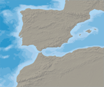
cross-blended-hypso-+-shaded-relief
Rasterized 10m vector polygons

More »

Coastline

Posted in 10m-physical-vectors on November 17th, 2009 by Nathaniel – Comments Off on Coastline
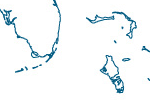
coast_thumb
Includes major islands.

More »

Land

Posted in 10m-physical-vectors on November 16th, 2009 by Nathaniel – Comments Off on Land
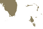
land_thumb
Land polygons including major islands.

More »

Minor Islands

Posted in 10m-physical-vectors on November 15th, 2009 by Nathaniel – Comments Off on Minor Islands
minor_is_thumb
Islands that are 2 sq. km or less in size.

More »

Reefs

Posted in 10m-physical-vectors, Featured on Homepage on November 15th, 2009 by Nathaniel – Comments Off on Reefs
reefs_thumb
Coral reefs and atolls.

More »

Ocean

Posted in 10m-physical-vectors on November 14th, 2009 by Nathaniel – Comments Off on Ocean
water_thumb
Ocean polygon split into contiguous pieces.

More »