Natural Earth version 1.2 release notes
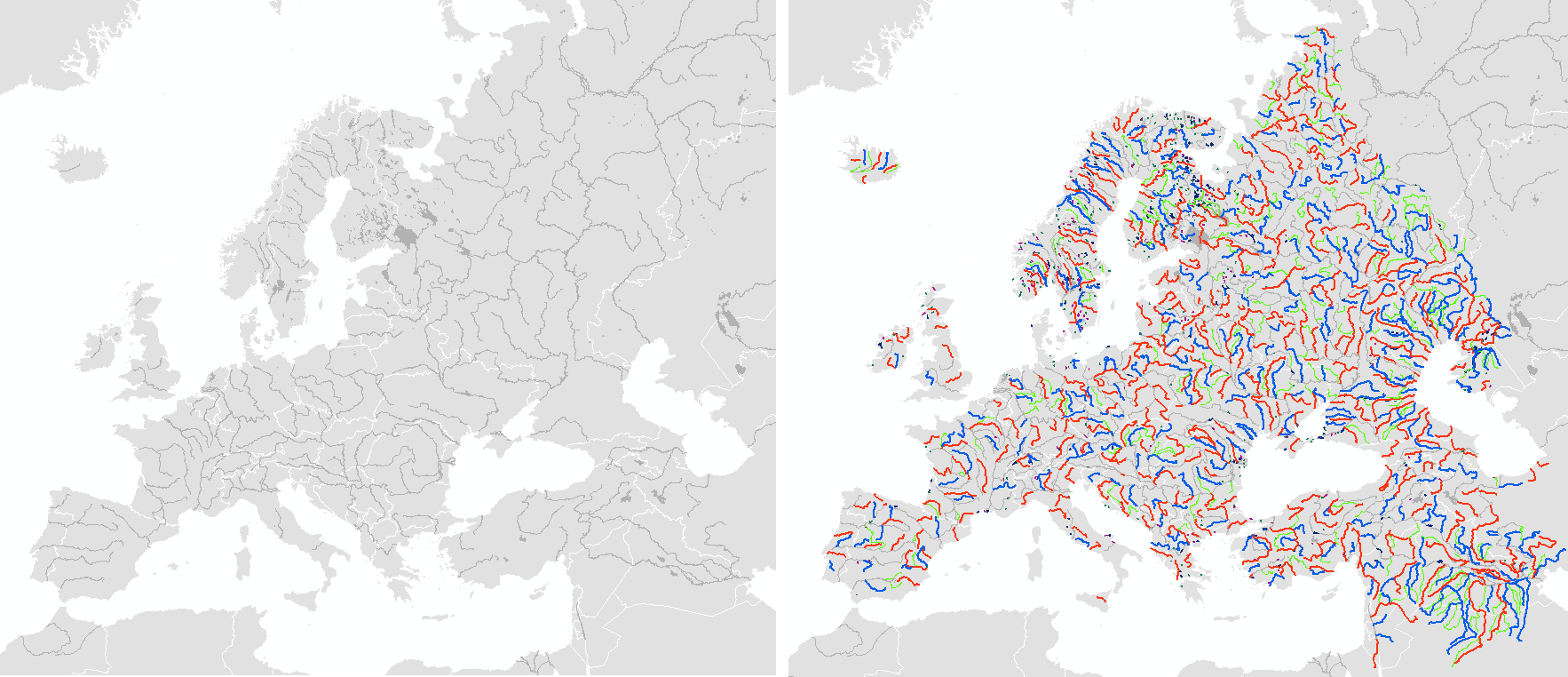
This update introduces supplementary hydrography features in North America and Europe that quadruple (4x) the number of lakes and rivers there. Many thanks to Tom P. for generalizing the vectors and Preston M. for adding tapering to North America (absent in Europe). In some cases the basic 10m rivers and lakes were modified to fit the new information and that’s been refreshed, as well. The North America data comes from the CEC North America Environmental Atlas. The Europe data extract is kindly provided into the public domain by the European Commission, Joint Research Centre (JRC), thanks Alfred J! Check out their original, higher resolution Europe data.
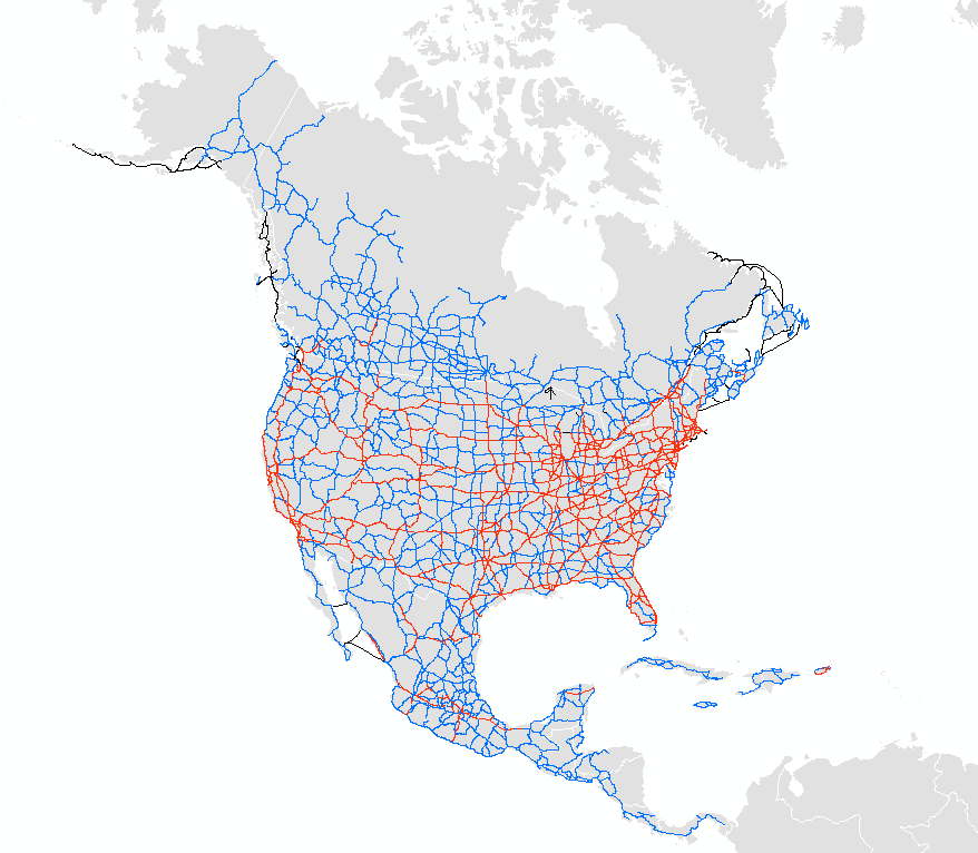
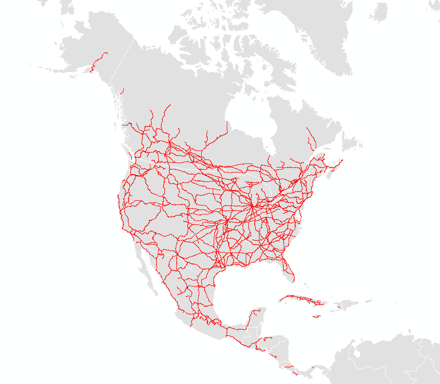
On the cultural front, North America gets roads and rails. General 10m detail roads and railroads come from the CEC North America Environmental Atlas. The supplementary roads are donated by XNR Productions and are at 1m scale, thanks Laura M. and Rob!
If you have data or time to contribute, especially to flesh out the new transportation and hydro themes, please contact me at nathaniel@naturalearthdata.com.
Note: We are not committing to building out supplementary level of detail in the rest of the world (we’re not THAT crazy!), but will incorporate such data if you contribute it. As always, we edit these data files but you should too before you publish maps using them. Feed us back corrections.
(below) Rivers and lakes in North America. On the left the version 1.1 hydro features. On the right in color are the new, supplemental version 1.2 hydro features, 4x the density of features at the same 10m linework generalization.
(below) Rivers and lakes in Europe. On the left the version 1.1 hydro features. On the right in color are the new, supplemental version 1.2 hydro features, 4x the density of features at the same 10m linework generalization.
(below) Highways (red and blue) and ferry routes in North America.
(below) Supplemental road detail in North America. Slightly different feature class scheme and data vintage.
(below) Railroads in North America.


I’m an engineer with GIS education and experience currently establishing GIS backbone for a state DOT’s bridge division (inventory of 15k structures). Our enterprise level GIS group (entrenched and defending GeoMedia) not friendly to ESRI users like me and I’m needing to find best (consistent) source for local road data (counties), and don’t know who (agency) that may be pulling together what’s available for Nebraska in public sector data at county level. Considering emergency address system data but know nothing about it as applies to our needs to manage bridges. Have state LRS and am exploring cross referencing with NHD as an LRS, someday. Target rich environment. Appreciate a discussion if you have time. Found your group through ESRI User Community Forum search for NHD, someone needing river data. Scoped out your website and I happen to be traveling to Madison next month (Nov 4-6), and could stop in to chat then. Your website referenced QGIS and that caught my attention for pleasure programming I’ve considered on my Mac at home. Thanks. Mike Munson; email for QGIS issues to mmunson@me.com .