Natural Earth Browser from Thematic Mapping
[Editor’s note: Bjorn over at his Thematic Mapping Blog has done up a Natural Earth tile set using open source tools. How have you been using Natural Earth?]
Excerpted from Thematic Mapping Blog.
My holiday project, apart from skiing, was to play with the new Natural Earth dataset. By combing raster and vector data you can make a variety of visually pleasing maps. You can use my Natural Earth Browser to study the great linework of Natural Earth.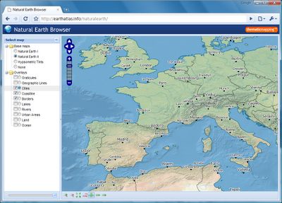
Natural Earth Browser was created with a variety of open source tools. Map tiles from raster data was created with MapTiler and optimised with pngng. Map tiles from vector data was styled with Mapnik and pre-genereated with TileCache. The map interface is based on OpenLayers, Ext JS and GeoExt.


