Prisma Shaded Relief

Posted in 50m-prisma-shaded-relief on October 10th, 2019 by Nathaniel – Comments Off on Prisma Shaded Relief
ne_prisma_shaded_relief

Grayscale shading based on Prisma artistic filtering

More »

Natural Earth v4.1.0 release notes

Posted in Miscellaneous on May 24th, 2018 by Nathaniel – 1 Comment

brazil-ne-4d1-names-languages

I’m proud to announce the immediate availability of Natural Earth version 4.1! See the CHANGELOG for full details. Here’s a quick summary:

  1. Expands the name localization added in v4.0 to 21 languages (up from 7) and several dozen themes expanding from populated places to include all admin-0, admin-1, rivers, lakes, playas, geographic lines, physical labels, parks, airports, ports, and more. As part of this work a new unique and stable “ne_id” has been added for any feature with a name translation &/or a Wikidata ID concordance. The full list of languages is: name_ar*, name_bn*, name_de, name_en, name_es, name_fr, name_el*, name_hi*, name_hu*, name_id*, name_it*, name_ja*, name_ko*, name_nl*, name_pl*, name_pt, name_ru, name_sv*, name_tr*, name_vi*, and name_zh. (Names with * indicate new language in v4.1 series.) A 2-character language code decoder ring. Props to Wikidata for their CC0 license. Want to see more name translations in the next Natural Earth release? Go edit Wikidata!
  2. Fixes admin-0 polygons for for Bosnia & Herzegovina to restore the Republic Srpska and the Brcko District condominium.
  3. Renames admin-0 Swaziland features to eSwatini to keep up with current events.
  4. Fixes physical label polygons to restore full geometries.
  5. Switches to MapShaper for topology building and joining of attributes for all administrative themes and 10m land and ocean themes. Some shapes were adjusted to fit new snapping tolerances.

Contributors

Many thanks to @imresamu for name translations and Wikidata concordances, @mattbloch for MapShaper feature development, and hat tips to @planemad for Wikidata concordances, Mapbox generally for leading the way with Wikidata name translations, and @thisisaaronland for ne_id work with Brooklyn Integers. Also to @randymeech and @bcamper at Mapzen (RIP) for sponsoring this work as a parting gift to the geo family.

Nathaniel Vaughn Kelso  2018 May 23

Natural Earth v4.0.0 release notes

Posted in Miscellaneous on October 30th, 2017 by Nathaniel – 3 Comments

natural-earth-v4-promo-banner

I’m proud to announce the immediate availability of Natural Earth version 4! After four months active development and more than 50 contributors Natural Earth v4 is now generally available on  NaturalEarthData.com and Github. See the CHANGELOG for full details. Here’s a quick summary:

  1. The v4 series introduces significant changes to admin-0 country shapes to account for the disputed area of Crimea, and several important admin-0 country name changes like Czechia renamed from Czech Republic. Admin-0 population and GDP values have also been updated to 2016/2017 vintage (primarily from CIA World Factbook).
  2. The v4 series introduces web map optimized min_zoom, min_label, and max_label properties that compliment the existing scalerank property that was originally curated for print cartography in proper projection glory. The min_zoom property is optimized for the web Mercator projection we are collectively hallucinating, and the min_label and max_label properties are optional on some themes when the label should be displayed later than the feature’s geometry (or should stop showing). A revised QGIS quickstart project is also included that makes use of the new zoom properties and is the source of the screenshot above.
  3. While the v3 series went full UTF-8 unicode (character encoding) language support a few errors were made along the way. v4 fixes bad Windows-1252 to UTF-8 conversion bugs (like for Zürich in the lower left corner of the image above). We also better document with the character encoding by adding a .cpg file to shapefile, and on the Natural Earth website documentation.
  4. More names in more languages! We added French names for marine areas way back in v1.4.0, and v4 adds many thousand more for populated places in the following languages: name_en, name_de, name_es, name_fr, name_pt, name_ru, name_zh. The existing name, name_alt, and nameascii fields have been updated, and name features over 600 labels with accent marks (versus the 80 or so that were garbled in the v3 series).

Contributors

Many thanks to the over 50 people who contributed over the last year of development, we couldn’t do it without you! Jeremy, @raffam, @pnorman, @mojodna, @imresamu, Hannes, Axel, @pinakographo, @CaucasusandMercury, @jschleuss, Martha, Kuba, Jesús, Arkadiy, Philip, Benedikt, Ivor, @almccon, Jacob, Alice, Geoffrey, @ajmas, @instantdelay, Matt, Daniel, Felix, @karimbahgat, @migurski, Olaf, @mvexel, @yaph, Jessica, @kernc, Quentin, Peter, @xangregg, Roland, Rob, @teahan36, @dgddgd, @dkerkow, Graham, Michel, @dshorthouse, @pinakographos, Alain, Aileen, Daniel, Charles, Martin, Aaron, MattA, StephenE, NathanielD, Aron, Lou, and others.

Nathaniel Vaughn Kelso  30 October 2017
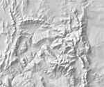
Manual Shaded Relief of Contiguous US

Posted in 10m-manual-shaded-relief on December 30th, 2015 by Nathaniel – Comments Off on Manual Shaded Relief of Contiguous US
ne_manual_shaded_relief_usa
Grayscale shading based on SRTM reference data

More »

Manual Shaded Relief

Posted in 50m-manual-shaded-relief on January 16th, 2015 by Nathaniel – Comments Off on Manual Shaded Relief
ne_manual_shaded_relief
Grayscale shading based on SRTM reference data

More »

FIXED: Downloads are 404ing

Posted in Blog Post, Miscellaneous on August 16th, 2014 by Nathaniel – 1 Comment

UPDATE: All download links should be working again as of Aug 19th.If you’re still finding a link that’s 404ing, please file a bug.

Well, that is embarrassing!

We’re soft relaunching NACIS.org (who sponsors Natural Earth) and looks like there was an undocumented dependency in the domain aliasing I need to fix.

In the meantime, you can download the files from GitHub:
http://github.com/nvkelso/natural-earth-vector/tree/master/zips

Should be back up Monday.
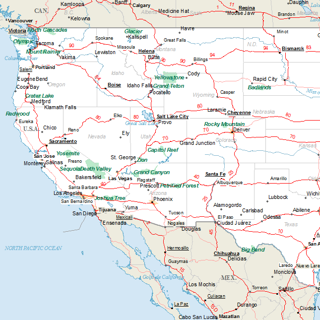
Natural Earth v2.0.0 release notes

Posted in Miscellaneous on November 8th, 2012 by Nathaniel – 4 Comments

We’re proud to announce the immediate availability of Natural Earth 2.0.0!

The 2.0.0 release focuses on 7 major areas and is available to download today à la carte at NaturalEarthData.
ZIP combo downloads of all vectors: SHP (279 mb) or SQLite (222 mb) or QuickStart kit for ArcMap and QGIS (165 mb).
  1. Economic geography: adds global roads, railroads, ports, airports, and time zones to show how people are interconnected and goods route (read Richard Florida on airports, full legal document about time zones and international date line shifts, and background on the E-Road network).
  2. Remastered geometries: fixes topological errors at 1:10 to 1:1,000 scales in the basic coastline, ocean, land, admin-0, and admin-1 related themes for files in the the 1:10m scaleset. By removing self-intersections, sliver polygons, and adjusting offset polygons, Natural Earth imports into more GIS software (like PostGIS) and will be easier to maintain. The coastline is adjusted to better conform to ~1:3,000,000 satellite imagery. Because of all these changes, some raster themes are also updated. Land, ocean, and minor islands all build topologically by scripting ingredients, as do the admin-0 and admin-1 cultural themes.
  3. Introduce Gray Earth rasters. Worldwide terrain depicted monochromatically in shades of gray. It combines shaded relief and regionally adjusted hypsography that emphasizes both high mountains and the micro terrain found in lowlands. View new raster »
  4. New file name and field name schemas. Full adoption of ne_10m_theme_name.shp file names with `ne_` prefix to allow better import into GeoDB and PostGIS storage, lowercase field (column) names instead of MiXeD and UPPER cased names, and use of consistent `name` field (versus name1).
  5. Address user submitted bug reports, ~25 since the 1.4 release, and earlier.
  6. Moved to Github for the backend versioned file management and coordination. Includes scripts to package updates and auto-create derived themes. View Natural Earth Vector on Github »
  7. Adopt semantic versioning. Know, by theme, the level of effort needed to update your maps when Natural Earth data updates are released. Read more about Natural Earth versioning »

Other notable changes:

All themes now include README and VERSION files. The admin-0 attributes have more veracity and now includes nested disputed areas (was a sidecar). Adds continent, region, subregion codes. Adds versions of country and admin-1 without boundary lakes.  All places and parts of places have population and GDP estimates. The populated places pop_max and pop_min attributes are now fully built out for all records (pop max is for the metropolitan area, pop_min is for the incorporated city of the same name). populated places now include rank_max and rank_min for simple town size grading. All instances of name1 have been changed to name, name to name, name2 to name_alt. Vertexes were added to many themes to allow them to project into conics smoothly (they’re back!). All field (column) names are now generally in the order of: scalerank, featurecla, name, name_alt, natscale, labelrank, *.

Contributors

Many thanks to the individuals who contributed over the last year of development: Tom, Nathaniel, Alex Tait, Hans van der Maarel, Scott Zillmer, Mike Migurski, Daniel Huffman, Chunshek Chan, Xan Gregg, Peter Bispham, Drew Noakes, Miguel Angel Vilela, Matthew Toro, Kevin Pickell, Shawn Allen, Robert Coup, Iain, Leo, and more! Thanks also to Stamen thru the Knight Foundation Citytracking grant for sponsoring a portion of this work including remastering geometries for better PostGIS import, the move to Github, and adopting semantic versioning.

Nathaniel Vaughn Kelso and Tom Patterson 8 November 2012
More »

Gray Earth with Shaded Relief and Hypsography

Posted in 10m-gray-earth on November 4th, 2012 by Nathaniel – Comments Off on Gray Earth with Shaded Relief and Hypsography
ne1_lc
Add your own oceans, rivers, and lakes.

More »

Gray Earth with Shaded Relief, Hypsography, and Flat Water

Posted in 10m-gray-earth on November 4th, 2012 by Nathaniel – Comments Off on Gray Earth with Shaded Relief, Hypsography, and Flat Water
ne1_lc_sr_h20
Add your own rivers and lakes.

More »

Gray Earth with Shaded Relief, Hypsography, and Ocean Bottom

Posted in 10m-gray-earth on November 4th, 2012 by Nathaniel – Comments Off on Gray Earth with Shaded Relief, Hypsography, and Ocean Bottom
ne1_lc_sr
Ocean bottom represented by CleanTOPO2 with reduced contrast.

More »