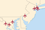
Airports

About
Derives from Mile High Club, a detailed GIS compilation of world wide airports that is in the public domain.

The “location” column is based on the above Airport infrastructure diagram (Source: Wikipedia).
Location values
Ordered best to worst
Terminal – Passenger terminal (not freight, not commercial or private pilot hangers).
If there is more than one terminal building, the International Terminal, followed by
Terminal 1, or the largest/central building. If multiple terminals are dispersed, the
centroid between them is used (often in a parking lot or round about area). See London
Heathrow for example. The military terminal is not preferred at joint civilian airports.
Parking – If terminals are spread out, use the centroid between them. Most often a parking lot.
Ramp – Pavement area outside the passenger terminal area. Used when terminal building is not clear
on airphoto interpretation.
Runway – Center of the runway. If more than one runway, the centroid. Some of these need
nudging over to the centroid. Can include taxiways if difficult to distinguish between
runway and taxiway on airphoto interpretation.
Approximate – Could be up to 20 miles away from the actual airport location.
More often it’s within a mile of the actual location. Accuracy is low due to geocoding
based on town name, use of DD.DD° or DD.DDDD° format instead of DD.DDDDDD° for latitude
and longitude values.
(below) North America.
Version History


