Cross Blended Hypso with Shaded Relief and Water

With Shaded Relief and Water
Land coloring based on elevation.
Add your own rivers and lakes
Land coloring based on elevation.
Add your own rivers and lakes
Download small size (97.46 MB) version 3.2.0
 About
About
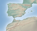
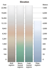
Shaded relief combined with custom elevation colors based on climate—humid lowlands are green and arid lowlands brown. As in nature, the map colors gradually blend into one another across regions (x and y axis) and from lowlands to highlands (z axis), hence the name cross-blended hypsometric tints. File size: 10,800 x 5,400 pixels.
Issues
None.
Version History
- 3.2.0
- 2.0.0
- 1.3
- 1.0.1 - Corrected TWF file bounding box extent.
- 1.0.0


