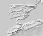
Manual Shaded Relief

Grayscale shading based on SRTM reference data
Download small size (17.15 MB) version 3.3.0
About
Drawn by Tom Patterson (January 2015) in Adobe Photoshop using a Wacom tablet and stylus. Digital relief generated from SRTM Plus elevation data served as a reference while drawing. Grayscale shaded relief of land areas only. The relief fits the 50 million-scale Natural Earth coastline, drainages, and spot elevations.. A flat gray tint fills water areas. File size: 10,800 x 5,400 pixels.
Version History
- 3.3.0 - First upload.
- 2.0.0


