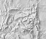
Manual Shaded Relief of Contiguous US

Grayscale shading based on SRTM reference data
Download medium size (11.52 MB) version 3.4.0
About
Drawn by Tom Patterson (December 2015) in Adobe Photoshop using a Wacom tablet and stylus. Digital relief generated from SRTM Plus elevation data served as a reference while drawing. Grayscale shaded relief of land areas only. The relief fits the 10 million-scale Natural Earth coastline, drainages, political boundaries, and spot elevations. Coverage also includes southern Canada, Mexico, Central America, and the Caribbean. A flat gray tint fills water areas. File size: 12,578 x 9,494 pixels.
Version History


