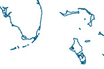
Coastline

Ocean coastline, including major islands. Coastline is matched to land and water polygons. The Caspian Sea, which is technically a lake, is included. The ocean coastline, the foundation for building all of NEV, primarily derives from World Data Bank 2 with modest generalization applied via line simplification in Adobe Illustrator. The Antarctica coast derives from NASA Mosaic of Antarctica.
(below) Yucatan peninsula, Cuba, and Hispaniola.

Issues
World Data Bank 2 coastlines have suspect accuracy for certain parts of the world, including northern Russia, southern Chile, and most egregiously, the west coast of the United States extending to the Baja Peninsula, Mexico, where the coast was approximately 7 km east of where it should be. The west coast of the US was corrected on NEV; other areas were not.
Does not include rank 6, 7, or 8 coastlines from the minor islands. Some rank 5 coastline should be reclassified as rank 6.
Resources
Version History


